

![BOARD 2 [Converted]-01.jpg](https://images.squarespace-cdn.com/content/v1/666313e0a84a390e77efbcd1/78522024-41dc-482d-bc3f-666eb3869ab0/BOARD+2+%5BConverted%5D-01.jpg)
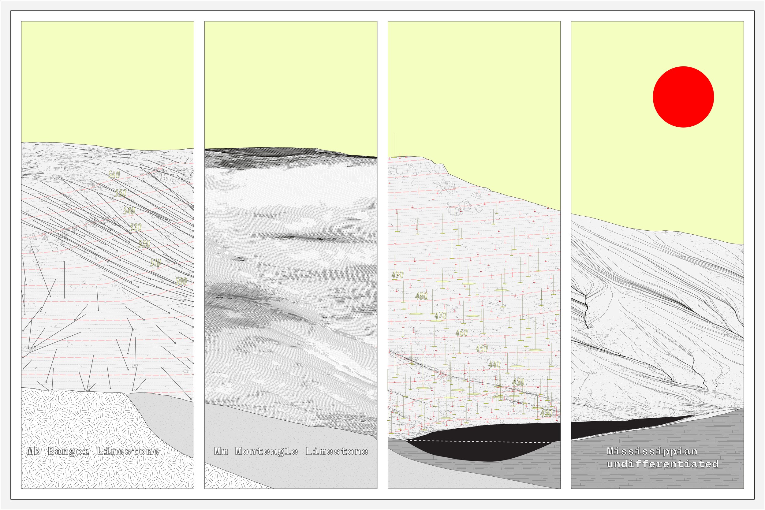
Throughout this course, we were tasked with expanding our knowledge of landform and landscape analysis. This entailed interpreting a landscape that fell along the Tennessee River from its 2D state, and determining existing watershed delineations, to gain both design constraints and opportunities for future earth moving interventions as well as to inform programmatic elements. It was critical we gain a greater understanding of the local hydrologic system as well as take inventory of basic landscape characteristics such as key indicator animal species, plant species, flux conditions, and water features, to build greater depth and clarity into our analysis. The work flow heavily relied digital modeling software such as Blender, Rhino 3D, and Grasshopper as well as mapping software like ArchGIS and Cloud Compare. The goal of this exercise was to explore the systems of a larger landscape format, speculate on how these systems correspond to or contradict one another, and identify how to dynamically represent systems in the landscape. The following drawings and diagrams are from this exploration on my site of Hambrick Hollow, Alabama.